Why Nairobi Feels Different From Any Other Equatorial City
Understanding the geography and climate of Nairobi explains almost everything visitors notice within their first 24 hours: the cool air, the rolling hills, the dramatic skies, the sudden rain showers, and the presence of wildlife and forests inside a major capital city.
This guide provides a complete, visitor-focused explanation of Nairobi City’s physical setting—how the land, altitude, rivers, and climate work together—and answers the most common questions travelers, planners, photographers, hikers, and first-time visitors ask.
Where Nairobi City Is Located (And Why It Matters)
Nairobi City lies in south-central Kenya, just south of the equator, but does not behave climatically like a typical equatorial city.
Key Geographic Facts
- Latitude: just south of the Equator
- Elevation: approximately 1,795 meters (5,889 feet) above sea level
- Position: between the Great Rift Valley (west) and the Athi Plains (east)
This elevated position places Nairobi on a highland plateau, fundamentally shaping its weather, vegetation, and livability.
Altitude: The Single Most Important Factor
The reason Nairobi feels cool, fresh, and temperate—even at the equator—is altitude.
What 1,795 Meters Above Sea Level Means
- Cooler daytime temperatures
- Significantly cooler mornings and evenings
- Less humidity than coastal or lowland cities
- More comfortable outdoor living year-round
Visitor Reality Check
Many first-time visitors expect tropical heat and are surprised to need:
- Light jackets or sweaters in the morning and evening
- Layers during cloudy or rainy days
This altitude advantage is why Nairobi historically attracted early settlers and why it remains Kenya’s most climatically comfortable large city.
Major Geographic Features Shaping Nairobi City

5
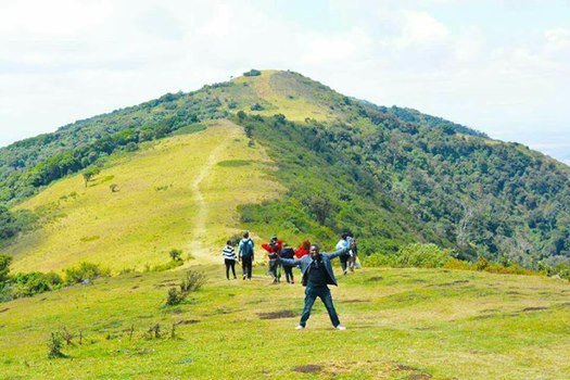
Ngong Hills (Western Boundary)
Ngong Hills rise to the west of Nairobi City and form one of its most important natural boundaries.
Why Ngong Hills Matter
- Act as a climatic barrier, influencing rainfall patterns
- Create dramatic western skylines and sunsets
- Feed river systems flowing into the city
- Shape wind movement and cloud formation
They also historically limited westward urban expansion and remain a key recreational and ecological zone.
The Athi Plains (Eastern Expansion Zone)
To the east, Nairobi transitions into the Athi Plains, a broad, open savannah landscape.
Characteristics of the Athi Plains
- Flatter, drier terrain
- Natural wildlife corridors
- Historically used for grazing and migration
- Continues south into Nairobi National Park
This open geography explains why Nairobi National Park exists where it does and why wildlife historically moved freely through the area.
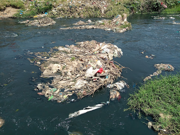
River Valleys: Nairobi’s Hidden Geography
Nairobi City is carved by several river systems that create green corridors and valleys cutting through the urban fabric.
Major Rivers
- Nairobi River
- Ngong River
- Mathare River
Why Rivers Matter
- Provide natural drainage in a high-rainfall environment
- Support riparian vegetation and birdlife
- Historically guided settlement and transport routes
- Create cooler microclimates in nearby neighborhoods
Many of Nairobi’s green spaces and informal settlements developed along these valleys due to access to water and fertile soils.
Wetlands and Seasonal Floodplains
Before urban development, large parts of Nairobi consisted of:
- Marshes
- Swamps
- Seasonal wetlands
These wetlands:
- Absorbed heavy rains
- Supported wildlife and bird migration
- Moderated flooding
Some modern flooding issues stem from building over these natural floodplains without adequate drainage replacement.
Climate of Nairobi City: What to Expect Month by Month
Overall Climate Profile
- Temperate highland climate
- Mild, comfortable temperatures most of the year
- Moderate rainfall compared to coastal or rainforest regions
Temperature Ranges (Typical)
- Daytime: 18°C – 26°C (64°F – 79°F)
- Nighttime: 10°C – 15°C (50°F – 59°F)
Extreme heat is rare, and extreme cold is virtually nonexistent.
Rainy Seasons in Nairobi City (Very Important for Visitors)
Long Rains: March to May
- Heaviest rainfall period
- Afternoon and evening showers common
- Lush landscapes and dramatic skies
- Some roads may flood temporarily
Short Rains: October to December
- Lighter, more intermittent rainfall
- Short, sharp showers
- Excellent for photography and greenery
Dry Seasons
- January–February
- June–September
These are popular periods for outdoor activities, safaris, and walking tours.
Why Nairobi Feels Cooler Than Coastal Cities
Visitors often ask why Nairobi feels dramatically cooler than places like Mombasa despite being closer to the equator.
The Reasons Are Clear
- Altitude – nearly 1,800 meters above sea level
- Lower humidity – less moisture in the air
- Highland winds – especially from Ngong Hills
- Cloud cover – moderates daytime heat
This makes Nairobi far more comfortable for walking, hiking, and city exploration.
How Geography Shapes Nairobi’s Lifestyle
Nairobi’s physical setting directly influences daily life:
Outdoor Culture
- Morning walks and runs
- Forest and park visits
- Hiking and cycling
- Weekend picnics
Architecture and Planning
- Sloped roofs for rain
- Drainage-aware road design (with mixed success)
- Tree-lined residential areas in older neighborhoods
Wildlife Integration
- National Park adjacency
- Birdlife throughout the city
- Occasional wildlife movement near southern boundaries
Best Time to Visit Nairobi City (By Interest)
Best Overall Weather
- June to September
- January to February
Best for Green Landscapes & Photography
- April and May
- November
Best for Walking Tours & Outdoor Activities
- June to August
- January
Best for Budget Travelers
- Rainy seasons offer lower accommodation rates
There is no bad time to visit Nairobi—only different experiences.
What to Pack for Nairobi City Weather
Visitors often under- or over-pack.
Essentials
- Light jacket or fleece
- Comfortable walking shoes
- Rain jacket (especially March–May, Oct–Dec)
- Sun protection (hat, sunscreen)
Heavy winter clothing or tropical beachwear is unnecessary.
Common Visitor Questions About Nairobi Geography & Climate (FAQs)
Why is Nairobi called the “Green City in the Sun”?
Because of its highland climate, abundant parks, forests, and green spaces combined with frequent sunshine.
Does it ever get very hot in Nairobi City?
Rarely. Heatwaves are uncommon due to altitude and cloud cover.
Does Nairobi experience flooding?
Yes, occasionally during heavy rains, especially in low-lying or poorly drained areas.
Is Nairobi affected by climate change?
Yes. Rainfall patterns are becoming less predictable, increasing flood and drought risks.
Can you do outdoor activities year-round?
Yes. Nairobi’s climate supports outdoor activity in all seasons with minimal adjustment.
Is Nairobi colder than other African capitals?
Yes, significantly colder than most low-lying equatorial or coastal capitals.
Why Geography Is Central to Understanding Nairobi City
Nairobi City’s geography is not background information—it is the foundation of the city’s identity. Its altitude, hills, plains, rivers, and climate explain:
- Why wildlife survives next to skyscrapers
- Why parks and forests matter so deeply
- Why walking and outdoor culture thrive
- Why Nairobi feels uniquely livable
For visitors and residents alike, understanding Nairobi’s natural setting transforms the city from confusing to coherent.